Queen Mary's LaneCircular WalkThe Lane's History Queen Mary's March Flora & Fauna Nearby |
Queen
Mary's Lane
Circular Walk

The route is dotted
with
four interpretation boards. To view one,
click on a board on the map 
(downloads large files each 4MB - 8MB)
(downloads large files each 4MB - 8MB)
 We have
opened a stretch of the ancient way called Queen Mary's Lane
for
permissive public access as a bridleway.
We have
opened a stretch of the ancient way called Queen Mary's Lane
for
permissive public access as a bridleway. We have also built it into a 2.5 mile / 4km circular walk for visitors to the Woodland Trust site at Pound Farm, Great Glemham, where there is a convenient car-park.
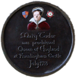
Queen Mary Tudor
The lane was named after the momentous events in 1553 when Mary Tudor was proclaimed Queen of England while marshalling her troops at nearby Framlingham Castle. It is assumed she led her army down this route to London to claim the throne from Lady Jane Grey—the 'Nine-Day Queen'. There Mary became the first woman to be crowned Queen of England in her own right.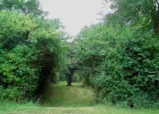 Today, the
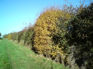
one remaining section of the original lane sweeps
through the edge of Queen Mary's Wood, between widely spaced ditched
banks on either side. As you drop down into the calm of this sunken
green lane you can imagine the awe of the peasants
working the surrounding fields as an army
of thousands marched through here, headed by their new Queen
on her white horse.
Today, the
one remaining section of the original lane sweeps
through the edge of Queen Mary's Wood, between widely spaced ditched
banks on either side. As you drop down into the calm of this sunken
green lane you can imagine the awe of the peasants
working the surrounding fields as an army
of thousands marched through here, headed by their new Queen
on her white horse. This website pieces together the history of this ancient pre-medieval lane displaying all the old maps and texts through the ages.
Queen Mary's Wood & Queen Mary's Plantation
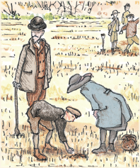
Queen Mary's march was not the only event in the lane's long history; it has other stories to tell. To find out more about any of the stories below, follow the links at the top-left of the page: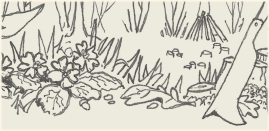 |
|
 |
|
||
 |
||
|
||
|
|
|
Queen Mary's Lane
lies along the
parish
boundary
between Parham and Great Glemham, near Framlingham in Suffolk, England.
|
Click
to enlarge this map
overlaid on the Ordnance Survey, which shows the other bridleways, tracks and minor roads that the new permissive paths connects up, just as the original Queen Mary's Lane did in its day.  Please follow the Countryside Code:
|
 |
This circular
walk is provided by JC Larter & Co in co-operation with the Woodland Trust. Capital works were part-funded by Natural England. Illustrations: www.wearedrab.net Interpretation board editorial: www.xtrahead.co.uk © JC Larter & Co, 2014 |
 |